Does your property sit next to preserved land, wetlands, or a protected buffer? If so, your boundary lines may not be where they seem. A fence line or an old plat map won’t show a conservation easement. Before you build, clear brush, add a driveway, or put up a shed near that line, a boundary survey can tell you exactly where your property ends and the protected land begins.
Hartford has preserved land in many neighborhoods and nearby towns. Some of it sits along rivers. Some of it belongs to land trusts. When a property sits next to one of these areas, the easement corners matter a lot. They often carry more legal weight than a regular property corner. A boundary survey finds these corners using old records, physical evidence, and careful measurements. This gives you a clear picture of what you can and can’t do near that line.
Reviewing Conservation Restrictions Before Boundary Fieldwork
Before a surveyor heads out to the property, someone needs to read the conservation easement document closely. This document is filed in the land records. It lists what you can’t do inside the easement area. It also shows where that area meets your property line.
A conservation easement can limit clearing, grading, building, or even mowing near a wetland or buffer zone. Some easements cover a whole backyard. Others cover just a narrow strip along a creek or tree line. Reading the easement, along with any maps attached to it, tells the surveyor what to look for. It also helps you understand what the survey will actually confirm.
The easement may mention a legal description, old monuments, or a past survey. All of that becomes part of the research. Older easements often use unclear language. This is one reason a new boundary survey is often needed when a property changes hands or when someone plans new work near the protected area.
Retracing Parcel Lines Along Preserved Land
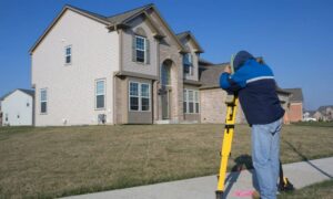
Once the research is done, the surveyor retraces the property lines. This means following the same legal description and evidence used when the lines were first set. The surveyor is not starting from scratch.
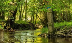
Near preserved land, this work often means digging through leaves, brush, or soil to find old monuments. These can be pins, pipes, or stone markers. Wooded and untouched areas are harder to survey than a mowed backyard. Markers can shift over time. They can also get buried or damaged.
The surveyor checks what’s found in the field against the old records. This confirms the lines match what’s on paper. If something doesn’t match, the surveyor notes it and works to fix it before finishing the survey. This step matters most if you plan to build near the conservation area. A wrong boundary line could lead you to disturb protected land by accident.
Locating Conservation Easement Corners From Record Evidence
The corners of a conservation easement are not the same as your regular property corners. They need their own check. These points are usually described in the recorded easement. The description may use coordinates, distances, or notes about physical markers set when the easement was created.
A surveyor finds these corners by matching the legal description to markers still in the field. Many easement corners were marked with iron pins, rebar, or concrete markers. Finding these markers, or resetting them if they’re missing, is a key part of the work.
Old records can also include easement maps, past surveys, or mapping data from a land trust or conservation group. Checking these sources against what’s found on the ground helps confirm the corners are placed correctly. It’s more than just guessing from a drawing.
Mapping Easement Limits for Future Property Decisions
Once the corners and lines are confirmed, the surveyor makes a map. This map shows the full easement area next to your property lines and any buildings already there. It becomes a useful tool for future decisions. That could mean planning a home addition, installing a fence, or just knowing how much usable land you have outside the restricted area.
If you’re planning construction or landscaping near preserved land, this map can show how much space you need to leave between new work and the easement line. It can also show where your driveway, utilities, or other structures sit compared to the restricted area. This matters if older work was done without knowing the exact easement limits.
This map can also help with local permits. Many towns want to see how a project relates to conservation restrictions before they approve it. Having an accurate map ready can help that process move faster.
Coordinating Boundary Findings With Easement Holders
A land trust, town, or conservation group usually holds a conservation easement. That group often wants to know what the boundary survey finds. Sharing the results with them helps make sure everyone agrees on where the restricted area starts and ends.
This step matters most if the survey finds a gap between the old records and what’s actually in the field. This could be a corner that no longer matches its original description. Easement holders often keep their own records or old surveys that can help sort out these gaps.
If you’re planning work near an easement line, ask the easement holder if you need extra approval before you start. The survey confirms where the line is. It does not replace any permission the easement may require.